
A23a, The World’s Biggest Iceberg Has Some Shocking Data

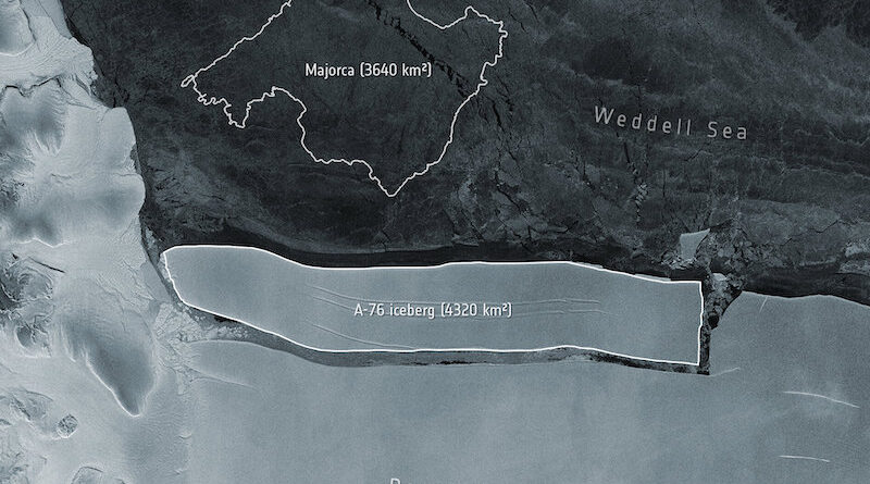
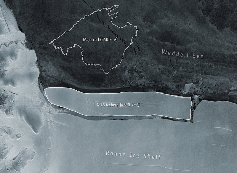
Scientists have just found out the size of the biggest iceberg on earth, called A23a. They have now good numbers to describe the massive size of this iceberg which has a total average thickness of over 280m (920ft). With a combined area of 3,900 sq km (1,500 sq miles), the iceberg has a volume of nearly 1,100 cubic km.
The iceberg which was calved in 1986 from the Antarctic Coast is just below a trillion tonnes. It is about to drift beyond the white continent. Experts are suggesting that the iceberg has reached a critical point in its journey and the next few weeks will decide its future trajectory through the Southern Ocean.
To make a more clear comparison, the new thickness data of A23a shows that the iceberg is more than twice the area of Greater London with the shape of a credit card. The European Space Agency’s CryoSat-2 mission has come up with the date for the biggest iceberg.
It is a veteran spacecraft that is equipped with a radar altimeter that can sense how much of an iceberg’s bulk is above the waterline or the sea level. By utilizing the information on the density of ice, it is possible to find out how much of it is submerged in the water.
Dr Anne Braakmann-Folgmann, from the University of Tromsø – The Arctic University of Norway, said, “Altimetry satellites like CryoSat-2, which measure the distance to the iceberg surface and to the sea surface, allow us to monitor iceberg thickness from space.” She further added, “They also enable us to watch the iceberg thinning as it gets exposed to warmer ocean waters. And together with knowledge of the sea-floor topography, we know where an iceberg will ground or when it has thinned enough to be released again.”
The A23a has been stuck in the shallow bottom mud of the southern Weddell Sea for around three decades and has become an ice island. However, it is not a uniform block as some of its parts are thicker than others.
CryoSat indicates that there was a particularly deep kneel that anchored the iceberg for so long. This submerged portion is around 350m and had a draft in 2018. The satellite images also show that surface crevasses are in violent collision with the sea. Gradually with time, the iceberg lost its mass and started moving along the sea.
Dr Andy Ridout, from University College London and the Natural Environment Research Council Centre for Polar Observation and Modelling, said, “Over the last decade, we have seen a steady 2.5m per year decrease in thickness, which is what you would expect given the water temperatures in the Weddell Sea.”
The iceberg has now reached the tip of the Antarctic Peninsula where fast-moving water turn clockwise around the continent. Prof Mike Meredith, from the British Antarctic Survey, said, “They’re responsible for very deep mixing of seawater, They churn ocean waters, bringing nutrients up to the surface, and, of course, they also drop a lot of dust.” he further added, “All this will fertilise the ocean – you’ll often see phytoplankton blooms in their wake.”